
Jan Freedman
Jan Freedman is the Geologist for the Royal Commission for AlUla. With a strong passion for science communication, he is studying the complex geology of the region so that the stories from the rocks can be told. Exploring different parts of AlUla, from jagged mountains made from 900 million year old volcanic rocks, to 500 million year old sandstones, he is keen that the narrative of geology is woven in for everyone to understand and enjoy.
Jan Freedman
Geologist for the Royal Commission for AlUla
The jeep pulled up between two cliffs. The air was clear, with the early morning sun slowly breaking the haze left by the dawn. I stepped out onto the soft sand and looked around me. I was in a wadi, or valley, sandwiched between immense cliffs that were a gateway to ancient worlds.
The group with me got their water, and a few snacks, while looking around at where we were. I looked too. We all saw the cliffs. At the top, light brown, with the deep shadows defining the sharp faces of erosion. And underneath, lots of broken rocks on top of more light brown rocks, sloping out to the ground. We were standing in the same spot, but we were looking at different things. They saw the cliffs. I saw the soft waves on a warm shallow beach, gently rushing in over the small sand grains. Here was the beginning of the Ridge Trail, a short 6km round hike. It was also the beginning of a walk through time.

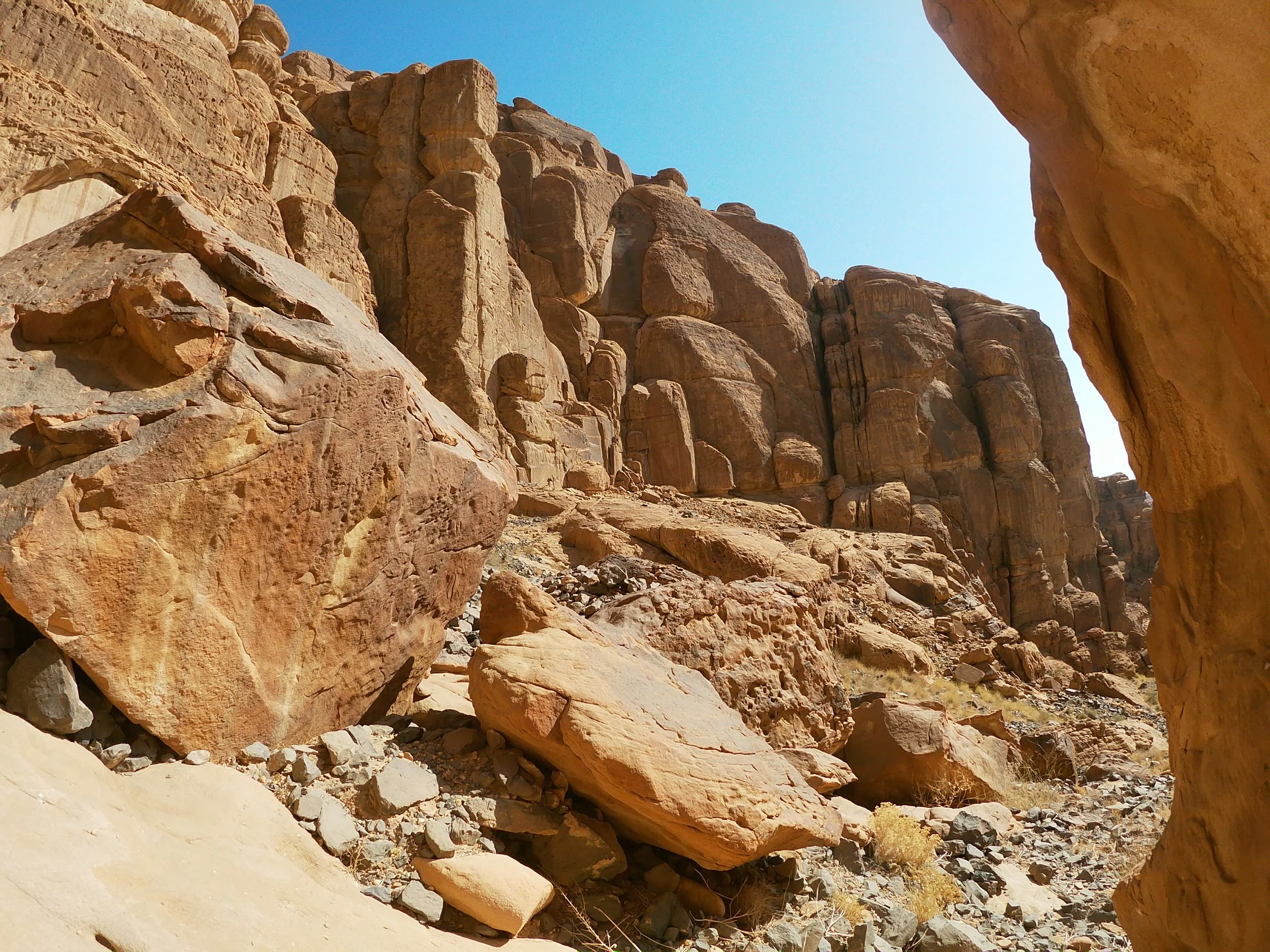
The cliffs at the start of the Ridge Trail. On the top, thick beds of 500 million year old sandstones. Underneath, the sloping rocks are more sandstones, around 520 million years old covered by broken boulders and rocks from the big layers above. (Photo Jan Freedman)
We continue up the zig-zag path, the group now excitedly and enthusiastically pointing out rocks to me, eager to find out more about what can be teased from the stones. The large boulders have come from the lighter brown sandstone above, and there are some pretty interesting things the budding geologists spot. Although it looks like one massive block of sandstone, when you look a little closer, you can see layers; some thicker and some thinner (we geologists call those beds). We see a big boulder with a flat top, but it is not so flat on the top, there are raised bits, that look like someone has badly rolled out some pastry. These are 500 million year old ripple marks in a slightly finer grained sandstone. Here, the tide came in over a fine sandy beach, and then out again, leaving ripple marks which have been preserved for half a billion years. There are boulders which show lots of really thin beds, showing lots of different times that sand was laid down, when the shallow sea was a little bit deeper.

500 million year old ripple marks. The rock is quite fine grained (made up of small grains of sandstone). This was a beach 500 million years ago, and preserved here is when the tide came in and then out again.
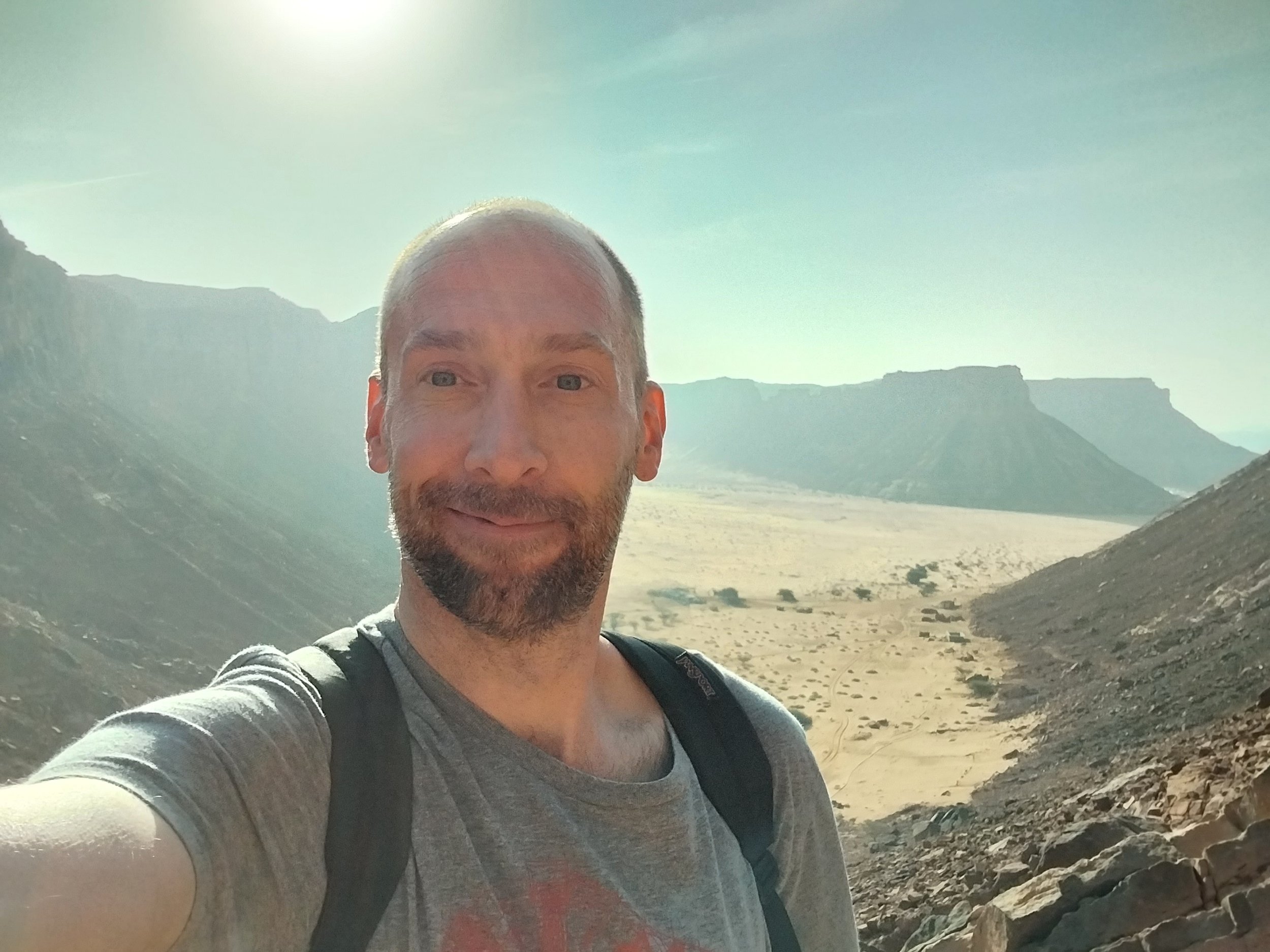
It’s not all big blocky sandstone though. As you are close to the top, after you have taken the mandatory selfie with the incredible views of the valley from this height, you see that there are different types of beds, thinner beds, some as thin as card, while others are slightly thicker. As you move up the rocks, you are also moving up through time. And over time, the environment changed. It wasn’t constantly a shallow sea. There were times when it was an enormous river. Other times then sea level was slightly higher, so there are lots of really thin beds showing a low energy environment. From a glance the rocks may look the same, but when you look a little closer, you see evidence of changing worlds.
We reach the top. The group hardly even notices that we are walking on much flatter ground and off the side of the cliff. I’m carrying a few rocks as the group carries on walking. Here, we find lots of holes in the rocks. Some of the rocks are loose and broken, filled with alien looking holes. Other holes splatter the large formations. They look like they belong on a planet in a Star Wars movie. These holes in the sandstone can be seen all over AlUla, from the remote parts of Sharaan Nature reserve to the rocks surrounding Old Town. They are a familiar feature here. These features in the rocks are called ‘tafoni’. They are formed by wind and water erosion. There is a weak point in the rock, mostly large pebbles. When the larger fragments fall, the sediment around them is looser, so the wind and water very slowly gouge out these areas quicker than the surrounding areas, grain by tiny grain over many, many years.
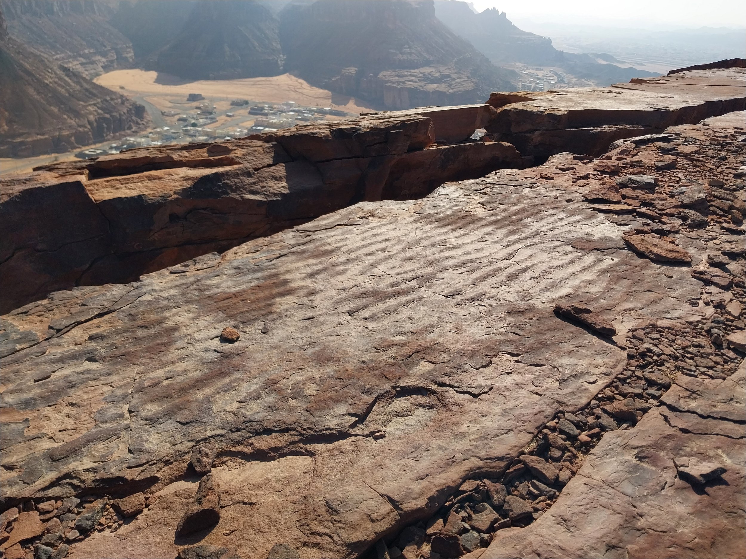
On the ridge, near the end of the walk, beautiful ripple marks preserved in the stone. The last remaining evidence of a moment in time where the tide came in and out creating little ripple marks in the sand.
I can feel the warmth of the sun as I see it. The ridge. It doesn’t look daunting, which is a good job, because I am not too great with heights. The ridge is fairly wide in most places. I focus on the rocks, and not on how extremely high up we are. And I see something quite amazing. More of those long bumps in the rocks: ripple marks. Here, right at the very top of this small mountain, despite the rain, despite the years of trampling from hundreds of human feet, despite 480 million years of time, there are some ripple marks preserved. A block about as long as I am, and about as wide as the length of my legs is all that is left of this time on a beach 480 million years ago. It would have spread out more, but that great destroyed of things, time, have reduced a huge beach to a single block. The fragility of our planet can be seen in the rocks.
Apparently we have walked a path that has been trodden for over a hundred years. The Otterman used this very path, and at the end we can see a small look out post that they would have used. It is a very good spot for a lookout post. It is one of the most incredible views I have ever seen. And there across the valley of date palms and beautiful old buildings is some more incredible geology. It is quite striking geology too. So far, we have seen sandstone. Lots of sandstone. Across the valley, on top of all the light brown sandstone, is a darker rock, and the entire top of the mountain is flat, like a table. This dark rock is called basalt, and it erupted from a volcano around 8 million years ago. These volcanoes weren’t explosive like you might imagine, these were more similar to the volcanoes in Hawaii, with the larva oozing out quickly like blood from a wound. There was a lot of lava that erupted, and it spread over hundreds of kilometers. Basalt is harder than sandstone, so it takes longer to break down by the wind or water, so it protects the sandstone beneath.
We start our hike. The side of the cliff looks impassable, but our guide leads us to a path. A path of small broken rocks, worn down through years of small groups of people taking this route over hundreds of years. I see sections of the lower sandstones, peeking out through the debris. The sandstone is a slightly darker light brown, with hints of red. The group walks ahead as I crouch down to take a closer look. I see small grains of quartz, some round, some slightly angular, but all smaller than a sunflower seed. This sandstone was formed by a shallow sea, 520 million years ago. But not only a shallow sea. The environment changed. A little bit higher up in this reddish sandstone, I saw pebbles, beautiful, round pebbles of quartz about as big as my thumb nail. This little section was formed by faster flowing water, fast enough to move those clear white stones and smooth them. Here was once a river. And then the environment changed again, and we see the shallow seas return. I stand and see the group is a little ahead, so I walk fast, and tell them about the rocks beneath their feet and how the rocks let us see what the area was like millions of years ago.

The group walking up through time.
The walk takes us close to the top, which was surprisingly easier, and less sweaty, than it looked. Here we walk alongside that light brown sandstone we could see as we stood and looked up at the cliffs. The sandstone isn’t hidden by fallen blocks, and we can see it and it is very blocky and very fractured. There are really thick layers, some thicker than I am tall! This was a time when an enormous amount of sediment was laid down that was eroded and washed down from the continent, around 500 million years ago, under shallow water. Then as more and more sediment piled on top, it was pushed down. Deep down. Into the Earth. All that water in the sediment was squeezed out. And inside the Earth is hot, even just a few miles down. This heat almost cooks the rock, water is boiled away, and the sediment hardens to rock. Millions of years later, it was thrust high above the ground, and millions of years of erosion have slowly, grain by grain, formed the landscape we know today.

In the distance you can see the younger 450 million year old sandstones.
We walk. The landscape looks barren, but there are signs of life. A small plant here, a tree across the path. A mound of freshly dug earth tells me that termites are just below the surface. Everyone in the group points out things to each other and talks. And I notice how calming everyone is talking; about the landscape around them; about how beautiful it is and how relaxing it feels to be outside. There is something that is calming about being outside in nature. There are no cars. No people. No ping of that next email. You are outside, in silence, surrounded by beauty. Science has actually shown it helps you clear your mind, as well as improving your breathing, and lowering your heart rate and blood pressure.
We walk over fractured beds, broken through a mixture of heat and pressure baking the rocks a little too much some hundreds of millions of years ago, and the never-ending erosion happening today. The ravages of time eventually destroys everything. Even mountains. There are some rocks and even whole beds that are a dark red, almost purple in colour. These are iron beds, where they contain much more iron, so have a deeper red colour. I pause to drink my water, and stretch my back from being hunched over glued to the rocks. Looking around, it is incredible. And I see the landforms in the distance. Now, this looks like something from Star Wars. These incredible landforms are the younger sandstones here in AlUla, around 450 million years old, and they are on top of the rocks we are walking across. It’s interesting to think that those rocks once covered this whole area, and most have slowly eroded away to leave no sign.
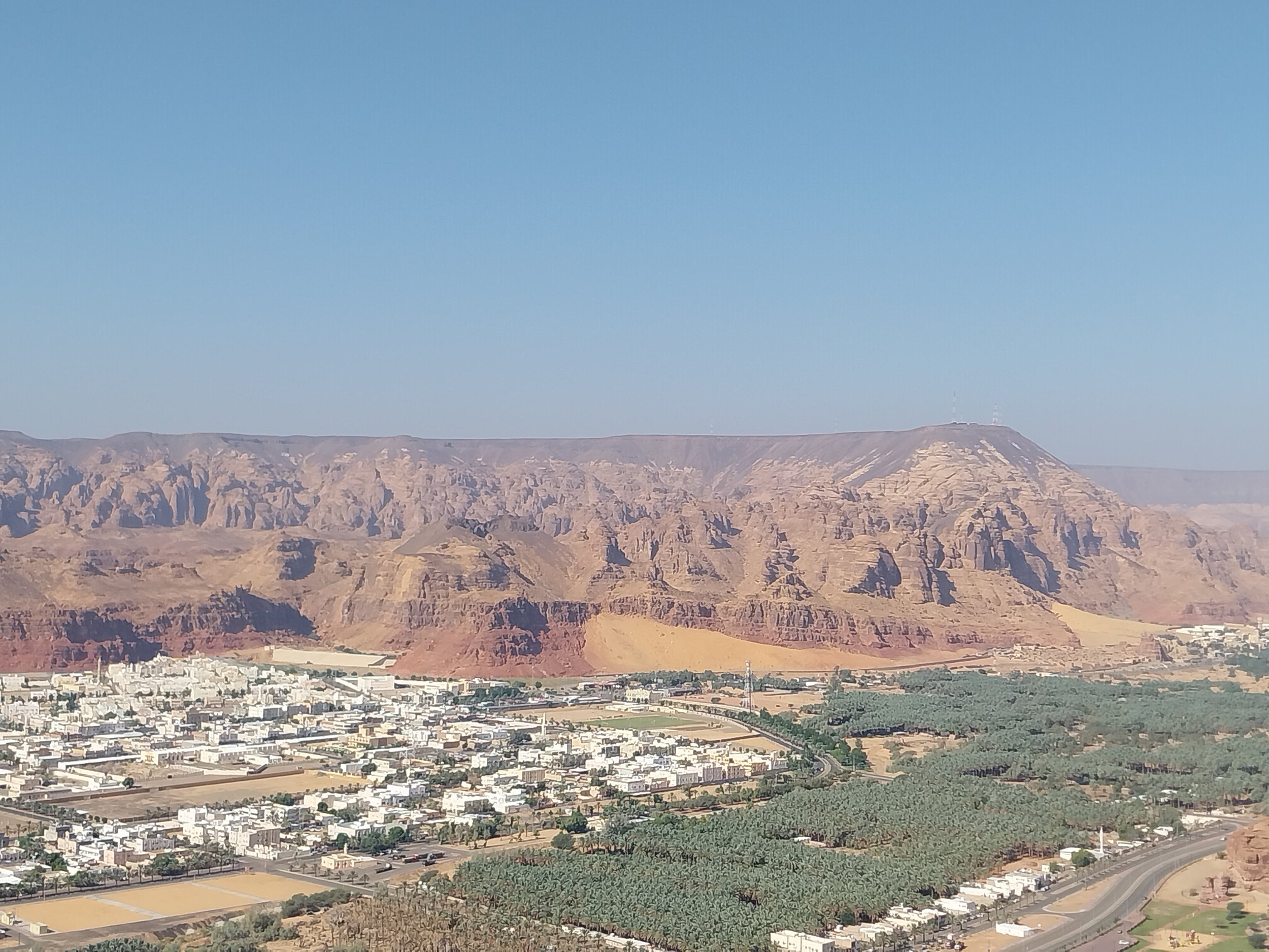
Looking across from the ridge to Harrat Uwayrid, you can see the same rocks that you have just climbed up, and also the lava that erupted from the volcano around 8 million years ago.
This was my first trail in AlUla, and it was such a beautiful one. Hiking up the side of the small mountain, and reaching the top to see some of the most incredible views I’ve ever seen, was incredible. AlUla is a unique place, and it’s the geology that makes it so unique. The landscape, forged by wind and water over thousands of years, literally takes your breath away. And that landscape, the striking enormity of the landscape, is even more spectacular when we look a little closer. For here, locked in the rocks, are signs of a world long vanished.